Brahmaputra River System Explained: Course, Tributaries & Ecological Importance
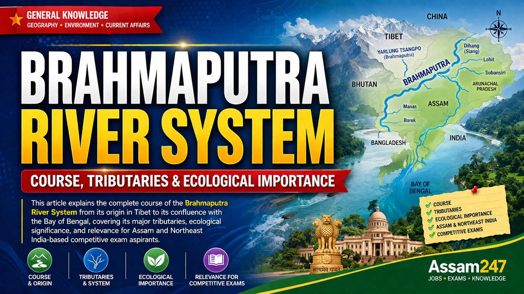
The Brahmaputra River is one of the largest transboundary rivers in Asia, flowing through the Tibet Autonomous Region of China, Northeast India, and Bangladesh before draining into the Bay of Bengal. For students preparing for the Assam Public Service Commission (APSC) Combined Competitive Examination, the Assam Direct Recruitment Examination (ADRE), and other government job examinations, the Brahmaputra River System is one of the most frequently tested geography topics because it directly shapes Assam's agriculture, flood patterns, biodiversity, and infrastructure planning. This article uses only verified data from the Government of Assam's Water Resources Department and the India Water Resources Information System (India-WRIS) to explain the river's course, tributaries, and ecological role. Readers preparing for exams should regularly review current affairs for APSC and ADRE to stay updated on recent developments related to river management in Assam.
ARTICLE THEME
This guide covers the Brahmaputra River System's complete geographical course across three countries, its major north bank and south bank tributaries in Assam, its basin characteristics, and its ecological and economic importance to Northeast India.
WHAT IS THE BRAHMAPUTRA RIVER SYSTEM?
The Brahmaputra River System refers to the main river channel along with all its tributaries, distributaries, and the drainage basin it forms across Tibet (China), India, and Bangladesh. The river originates near the Angsi Glacier in southwestern Tibet, close to the Lake Manasarovar and Mount Kailash region, at an elevation of approximately 5,150 to 5,300 metres (Source: India-WRIS, Ministry of Jal Shakti).
In Tibet, the river is known as the Yarlung Tsangpo. After entering Arunachal Pradesh in India, it is called the Siang or Dihang. Once it merges with the Lohit and Dibang rivers in Assam, it takes the name Brahmaputra. After entering Bangladesh, it is renamed the Jamuna, where it eventually merges with the Ganga (locally called the Padma) before emptying into the Bay of Bengal through the Sundarbans delta. The Brahmaputra is unusual among major Indian rivers in that it is referred to in the masculine gender, unlike the Ganga, Yamuna, or Godavari.
WHY THIS TOPIC MATTERS
The Brahmaputra River System is central to Assam's identity, economy, and disaster-management policy, making it a recurring topic in both competitive examinations and real-world governance. The river's braided channels and seasonal flooding directly affect millions of residents in the Brahmaputra Valley every year, which is why river management appears frequently in Assam Government Schemes and State Budget allocations. For APSC and ADRE aspirants, questions on the Brahmaputra's course, tributaries, and basin states are asked almost every year in the General Studies and General Knowledge sections. Students can strengthen their preparation using MCQ practice with 3000+ questions to test their retention of river geography facts before appearing for these exams.
KEY FACTS AND HIGHLIGHTS OF BRAHMAPUTRA RIVER
- Total length of the Brahmaputra River: approximately 2,900 kilometres from source to mouth (Source: Government of Assam, Water Resources Department, 2026).
- Length within India: approximately 916 kilometres (Source: India-WRIS, Ministry of Jal Shakti).
- Total basin area across all countries: approximately 5,80,000 square kilometres spread over Tibet, Bhutan, India, and Bangladesh (Source: Government of Assam, Water Resources Department).
- Basin area within India: approximately 1,94,413 square kilometres, accounting for nearly 5.9 percent of India's total geographical area (Source: India-WRIS).
- Indian states in the basin: Arunachal Pradesh, Assam, Meghalaya, Nagaland, West Bengal, and Sikkim (Source: India-WRIS).
- Number of tributaries joining in Assam: about 20 major tributaries on the north bank and 13 on the south bank between Kobo and Dhubri (Source: Government of Assam, Water Resources Department).
- Maximum recorded discharge: 72,779 cumecs at Pandu near Guwahati, recorded on 23 August 1962 (Source: Government of Assam, Water Resources Department).
- Minimum recorded discharge: 1,757 cumecs, recorded on 22 February 1963 at the same station (Source: Government of Assam, Water Resources Department).
- Average annual discharge: approximately 20,000 cumecs (Source: Government of Assam, Water Resources Department).
Students who want to explore these facts in a structured, exam-oriented format can refer to the Knowledge Enhancement section for topic-wise breakdowns of Assam's rivers, wetlands, and geography.
DETAILED EXPLANATION: COURSE OF THE BRAHMAPUTRA RIVER
Course Through Tibet
In Tibet, the Yarlung Tsangpo flows eastward for more than 1,600 kilometres across the Tibetan Plateau before making a sharp southward turn through the Namcha Barwa Gorge, one of the deepest gorges in the world (Source: India-WRIS). Along this stretch, the river drops nearly 4,800 metres in elevation over about 1,700 kilometres, giving it a very steep average gradient of roughly 2.82 metres per kilometre (Source: Government of Assam, Water Resources Department). This steep Himalayan gradient is the primary reason the river carries an extremely high sediment load into India.
Course Through Arunachal Pradesh and Assam
After entering Arunachal Pradesh, the river is known as the Siang or Dihang. It is joined by two major tributaries, the Dibang and the Lohit, near Kobo in Assam, after which the combined river takes the name Brahmaputra (Source: India-WRIS). Once the river enters the Assam Valley, its gradient falls sharply to about 0.1 metres per kilometre, a drastic flattening compared to its course in Tibet (Source: Government of Assam, Water Resources Department). This sudden change in slope, combined with a heavy sediment load, causes the river to become braided, meaning it splits into multiple shifting channels separated by sandbars and islands rather than flowing in a single defined path.
Course Through Bangladesh
After flowing through Assam and entering Bangladesh, the river is renamed the Jamuna. It eventually merges with the Ganga, locally known as the Padma, and the combined river flows into the Bay of Bengal through the Sundarbans, forming the largest river delta in the world (Source: India-WRIS).
Major North Bank Tributaries in Assam
The principal tributaries joining the Brahmaputra from the north, largely originating in Arunachal Pradesh and Bhutan, include the Subansiri, the Jiabharali (also called the Kameng), the Dhansiri (North), the Manas, the Torsa, the Sankosh, and the Champamati (Source: India-WRIS). These north bank tributaries are generally larger and carry snow-fed and monsoon-fed water from the Eastern Himalayas.
Major South Bank Tributaries in Assam
The principal tributaries joining from the south, mostly originating in the Naga Hills, Patkai range, and the Meghalaya Plateau, include the Burhi Dihing, the Desang, the Dhansiri (South), the Kopili, and the Kulsi (Source: India-WRIS). South bank tributaries tend to be shorter but contribute heavily to seasonal flash flooding in Upper and Central Assam.
Braided Channels and River Islands
The combination of a flattened gradient and heavy sediment deposit causes the Brahmaputra to constantly shift its channels within the Assam Valley, a process that has created some of the world's most distinctive river islands. Majuli, located in Assam, is recognised as one of the largest inhabited river islands in the world and has been included in UNESCO's tentative list for World Heritage status (Source: UNESCO World Heritage Centre). The river's shifting nature also causes continuous erosion and land loss along its banks, a challenge that state authorities address through embankment construction and river-training works managed by the Brahmaputra Board.
REAL-WORLD EXAMPLES AND USE CASES
The Brahmaputra's floodplains support Kaziranga National Park, home to the world's largest population of the one-horned rhinoceros, and Dibru-Saikhowa National Park, both of which depend on the river's annual flooding cycle to maintain their grassland and wetland ecosystems. The river also feeds Deepor Beel, a Ramsar-designated wetland near Guwahati, which is discussed in detail in the Wetlands of India and Assam explainer covering Ramsar sites and conservation law. In terms of infrastructure, the Brahmaputra Board and the National Hydroelectric Power Corporation have identified significant hydropower potential across the basin's tributaries in Arunachal Pradesh, though large-scale project implementation remains a subject of ongoing environmental review, particularly around downstream impacts in Assam.
COMMON MISUNDERSTANDINGS
A frequent error among exam aspirants is assuming the Brahmaputra originates in India; in reality, it originates in Tibet as the Yarlung Tsangpo and enters India only after crossing more than half its total length. Another common misunderstanding is treating "Siang," "Dihang," and "Brahmaputra" as three separate rivers rather than three names for the same river system at different stages of its course. Students also sometimes confuse the Brahmaputra's basin area figures, since national portals often cite slightly different numbers depending on whether they measure the basin within India alone or the entire transboundary basin across all four countries; this article uses the Government of Assam and India-WRIS figures specifically for accuracy.
IMPACT ON STUDENTS AND SOCIETY
For APSC and ADRE aspirants, a clear understanding of the Brahmaputra's course, tributaries, and basin states is essential, since geography questions in these examinations frequently test river systems alongside related topics such as flood management, wetlands, and biodiversity hotspots. Beyond examinations, the river directly affects livelihoods across Assam through agriculture, fisheries, inland waterway transport, and flood-related disaster management, creating career opportunities in hydrology, disaster management administration, and environmental governance roles within state departments. Aspirants preparing for such roles can review the latest job and exam updates and explore all upcoming exams related to water resources and disaster management departments in Assam.
IMPORTANT CLARIFICATION
While several public sources cite the Brahmaputra's total basin area as either approximately 5,80,000 square kilometres (transboundary total) or approximately 1,94,413 to 1,97,316 square kilometres (India-only figure), these are not conflicting numbers but measurements of different geographic extents. Readers should note which figure a given source is referring to before citing it in written examinations.
KEY TAKEAWAYS
- The Brahmaputra originates as the Yarlung Tsangpo in Tibet and becomes the Brahmaputra only after entering Assam near Kobo.
- Its total length is approximately 2,900 kilometres, with only 916 kilometres flowing through India.
- The river's basin covers six Indian states: Arunachal Pradesh, Assam, Meghalaya, Nagaland, West Bengal, and Sikkim.
- About 20 tributaries join from the north bank and 13 from the south bank within Assam.
- The river becomes braided in the Assam Valley due to a sharp drop in gradient combined with heavy sediment load.
- Majuli, formed by the river's shifting channels, is one of the world's largest inhabited river islands.
- The Brahmaputra sustains major protected ecosystems including Kaziranga National Park and Deepor Beel wetland.
- The river is a recurring and high-weightage topic in APSC, ADRE, and UPSC geography sections. Aspirants can test their preparation with free daily mock tests covering this and related geography topics.
OFFICIAL SOURCES AND REFERENCES
- Government of Assam, Water Resources Department — Brahmaputra River System official page, 2026.
- India Water Resources Information System (India-WRIS), Ministry of Jal Shakti, Government of India.
- UNESCO World Heritage Centre — Tentative List entries for India.
- Ministry of Environment, Forest and Climate Change (MoEFCC), Government of India.
FREQUENTLY ASKED QUESTIONS
Q1. Where does the Brahmaputra River originate?
A1. The Brahmaputra originates near the Angsi Glacier in southwestern Tibet, close to the Lake Manasarovar and Mount Kailash region, at an elevation of approximately 5,150 to 5,300 metres, where it is known as the Yarlung Tsangpo.
Q2. What is the total length of the Brahmaputra River?
A2. The Brahmaputra River is approximately 2,900 kilometres long from its source in Tibet to its mouth at the Bay of Bengal, of which about 916 kilometres flows through India.
Q3. Why is the Brahmaputra called a masculine river?
A3. Unlike most major Indian rivers, which are traditionally referred to in the feminine gender, the Brahmaputra is referred to in the masculine gender in Indian tradition and literature.
Q4. What are the major north bank tributaries of the Brahmaputra in Assam?
A4. The major north bank tributaries include the Subansiri, Jiabharali (Kameng), Dhansiri (North), Manas, Torsa, and Sankosh, most of which originate in Arunachal Pradesh and Bhutan.
Q5. What are the major south bank tributaries of the Brahmaputra in Assam?
A5. The major south bank tributaries include the Burhi Dihing, Desang, Dhansiri (South), Kopili, and Kulsi, which mostly originate in the Naga Hills, Patkai range, and Meghalaya Plateau.
Q6. Why does the Brahmaputra become braided in Assam?
A6. The river's gradient drops sharply from about 2.82 metres per kilometre in Tibet to about 0.1 metres per kilometre in the Assam Valley; this sudden flattening, combined with a heavy sediment load, causes the river to split into multiple shifting channels, a pattern known as braiding.
Q7. Which Indian states fall within the Brahmaputra basin?
A7. The Brahmaputra basin in India covers Arunachal Pradesh, Assam, Meghalaya, Nagaland, West Bengal, and Sikkim.
Q8. What is Majuli and how is it connected to the Brahmaputra?
A8. Majuli is a river island formed by the shifting channels of the Brahmaputra in Assam and is recognised as one of the largest inhabited river islands in the world; it has also been placed on UNESCO's tentative list for World Heritage status.
Q9. What name does the Brahmaputra take in Bangladesh?
A9. After entering Bangladesh, the Brahmaputra is renamed the Jamuna, which later merges with the Ganga (Padma) before draining into the Bay of Bengal through the Sundarbans delta.
Q10. Why is the Brahmaputra River System important for APSC and ADRE exams?
A10. The Brahmaputra River System is a high-weightage topic in APSC and ADRE General Studies sections because it connects geography with Assam-specific themes such as flood management, wetlands, biodiversity, and state government schemes, making it a frequently repeated examination topic.
Q11. What is the maximum recorded discharge of the Brahmaputra?
A11. The maximum recorded discharge of the Brahmaputra was 72,779 cumecs, measured at Pandu near Guwahati on 23 August 1962, according to the Government of Assam's Water Resources Department.
Q12. Which national parks depend on the Brahmaputra's flooding cycle?
A12. Kaziranga National Park and Dibru-Saikhowa National Park both depend on the Brahmaputra's annual flood cycle to maintain their grassland and wetland habitats, which support species including the one-horned rhinoceros.
Related Articles